Trail Guide - Domodossola
Issue 74 / Mon 20th Mar, 2023
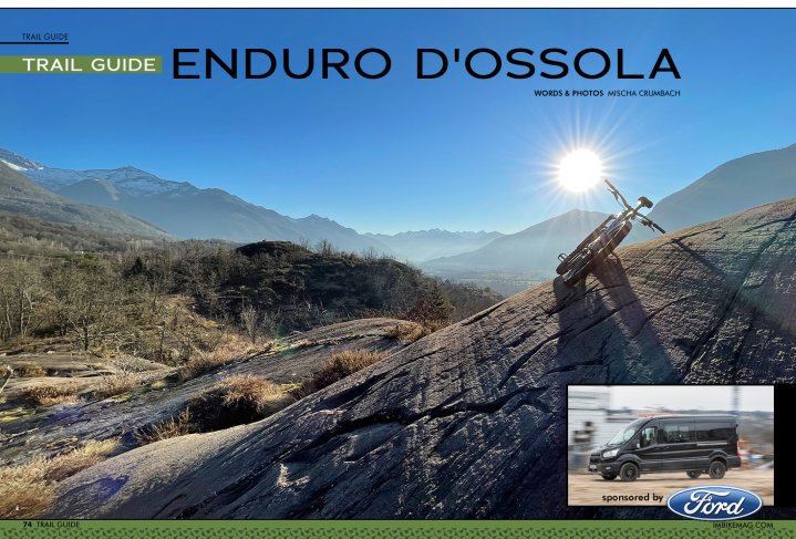
Getting lost in Italy’s secret enduro destination.
The North Italian Ossola valley is a perfect place for experienced bikers. It is little known outside its own borders – even in Italy. Imagine technically challenging rock slab trails free of snow all year round, remote high alpine passes, cosy mountain huts, excellent Italian food and drinks, all being just an hour and a half away by train from, e.g., Bern in Switzerland or Milano. So there must be a catch – it’s damn easy to get lost in many ways …
Lost in the woods
It’s half past 6 pm at the end of September. The often barely visible but awesome trail that I followed down a mountain ridge for almost 1’000 vertical metres just ended in the middle of a steep forest. My mobile phone battery is at 5%, I've been out of water for about one hour, and the sun is already behind the mountains.
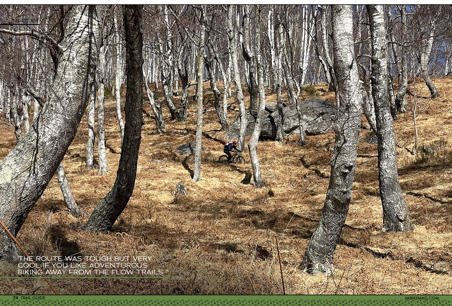
I’m on a recce trip in a side valley above Domodossola trying to find a challenging route down to Domodossola for a two-day bike crossing starting at the Simplon Pass in Switzerland. So far, the route was tough but very cool if you like adventurous biking away from the flow trails and do not mind carrying your bike uphill to reach the best trails. But now I need to find a way out. Returning is not an option, it is way too far …
Lost on maps
I check the two different maps on my phone. One shows houses a little bit back up the mountain and a trail starting there. I didn’t see any, so I doubt it. The other map shows a trail around 100 m below me – good! So I scramble down between the trees. No trail! So I revert back to the first map – the potential houses above. Quite exhausting after this long day, and indeed, I was right: NO houses where the map shows them. I decided to descend again but this time I go about 200m further down, as there should be a trail that I know. Suddenly as I am making my way through the leafy forest, a trail is coming from above out of nowhere. This one is on none of those maps! I am lucky, and safe.
Lesson learned: There are no reliable maps of this region. In some cases, Open Street Map is pretty ok, in some cases Swisstopo Map, but both can be totally off. And some of the best trails are on neither of them. Instead, they show plenty of trails that do not exist anymore. I also once used the Strava Heat Map – normally I avoid its bright lines and explore its dark areas, but for once I wanted to see the ‘main trail’ in my research area. Apparently, the local bikers don’t mind walking down trails after long uphills…
So, if you go exploring on your own, be prepared for some surprises. Good news is that slowly some of the trails are introduced on Trail Forks or the Swiss Single Trail Map, but both bare surprises, too.
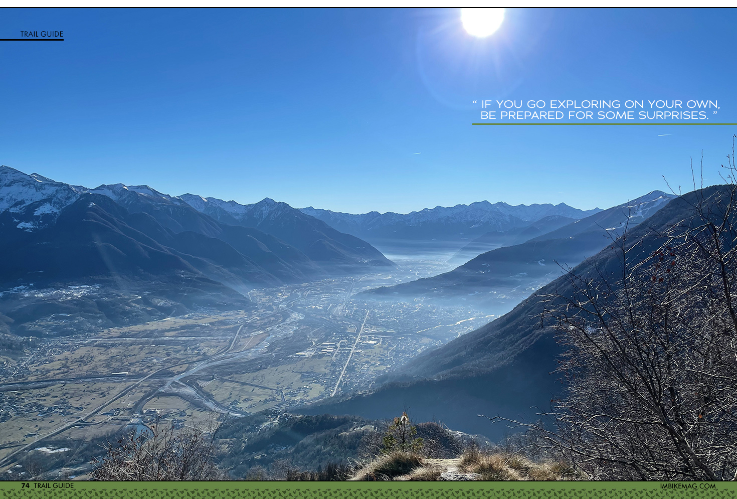
It seems that the region has identified biking as a tourist opportunity, but there is very little signposted infrastructure yet. In contrast, on a website of the tourism office I recently found some bike route suggestions that are perfect if you want to kill yourself on a 2’000 vertical meter uphill with many hike-a-bike sections, then push your bike downhill (unless you ride like Danny McAskill) to the closest fire road and race this road all the way back down. At least this is consistent with my Heat Map experience described above, but it doesn’t fit what I am looking for as an experienced biker: a technical but feasible challenge (meaning black/expert level, but not orange/extreme)…
Lost in winter
Yet, they exist indeed: Awesome trails, mostly centuries old, of natural character, often rocky and technical (think hiking trails in Ticino) but also a growing portion of fun stuff shaped by the locals not far away from the city of Domodossola. The city is located at 270 m a.s.l. on the southern side of the alps. This means the trails around Domo (as it is called by many) are rideable all year round. And on the southern exposed hillsides you can normally go to 1’300 m a.s.l. and reach a couple of truly iconic trails all winter.
One of my favourite places is the area around Montecrestese and Crevoladossola north of Domo. It offers fantastic slick rock riding: the million year old gneiss rocks were polished by the glaciers of the ice ages – probably the oldest ‘trail builders’ of them all. Above those playgrounds are the forests on the southern exposed slopes – wide open birch tree woods. I just love when they are flooded by the low winter sun and the dried fern and grass on the ground is glowing golden. The trails in these woods have many technically challenging sections (black/expert level), but there are always some easier sections to relax.
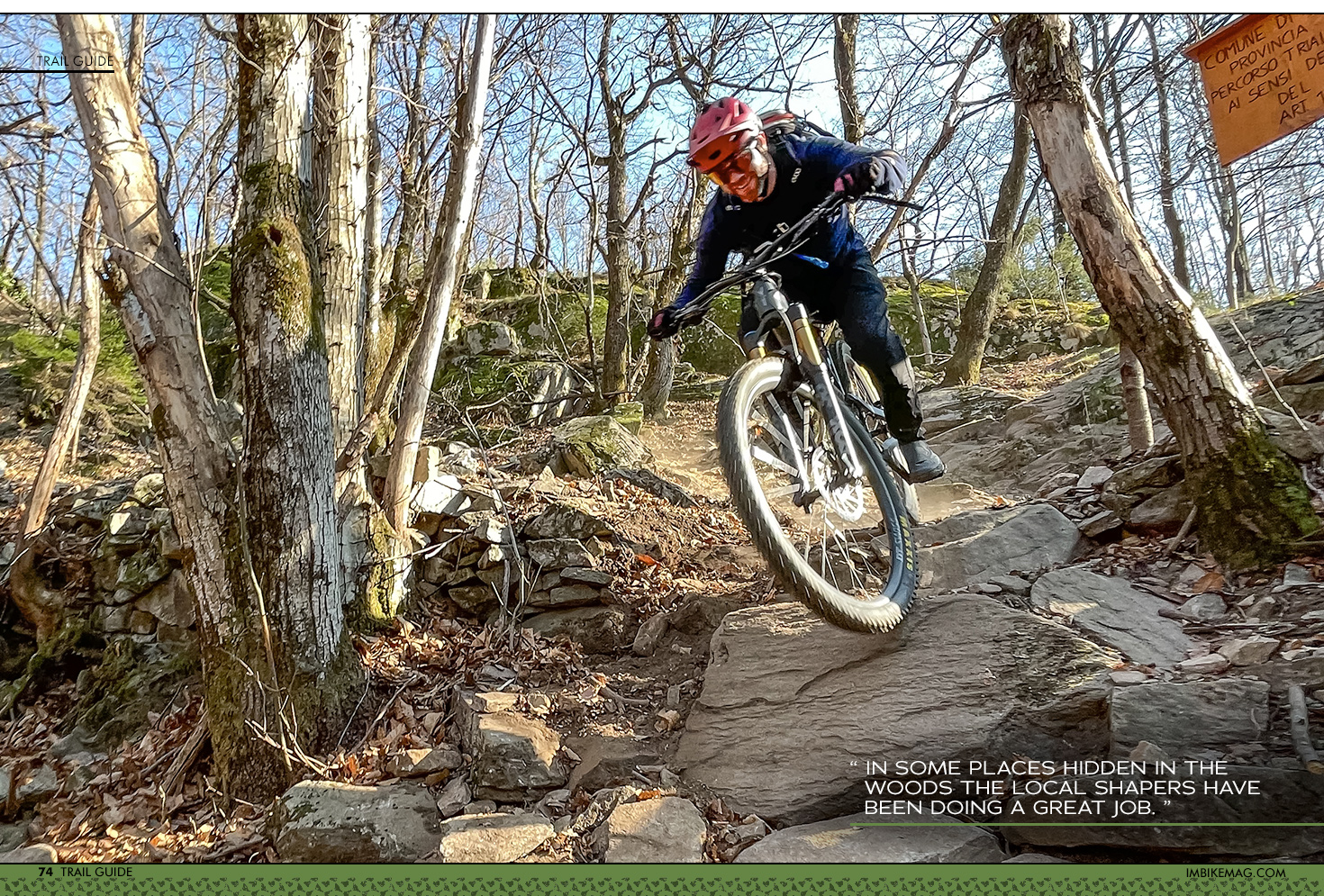
Furthermore, in some places hidden in the woods the local shapers have been doing a great job. This winter I checked a loop popular with the locals going through the village of Trontano. With some trial and error and supported by Trail Forks I did find it: less technical (up to red/advanced), and the downhill part did put a wide ‘flow-grin’ on my face. Thanks a lot to the unknown trail builders!
Another great winter option is to enjoy the sunny side of the lower Bognanco valley. Linking picturesque mountain villages with partially very technical trails is quite my cup of tea. Early in spring I like to explore the Valle Cairasca above Varzo. So far I was rewarded with a killer technical trail, the ‘F6’, but I know that there is still more.
Also the forested slopes below the ski area of Domobianca directly southwest above Domodossola become interesting during spring. Several trails have been shaped there and are visible on Trail Forks. I thought: “This will be good to find, too easy a prey”. So, I only checked them in early March this year for the first time. I was wrong. Many of the shaped parts that I checked were hard to find since they were covered under leaves – up to knee deep.

So far, I didn’t find anything special, except for the trail signage that in some parts was quite ‘creative’. I concluded to ignore the meaning of the various symbols and reduce it to “There is something coloured on a tree, it must be ok”. But since there are several more trails in this area, my final verdict about it is still open. And a fresh round of trail maintenance will for sure change the picture a lot, so it’s worth checking back another time.
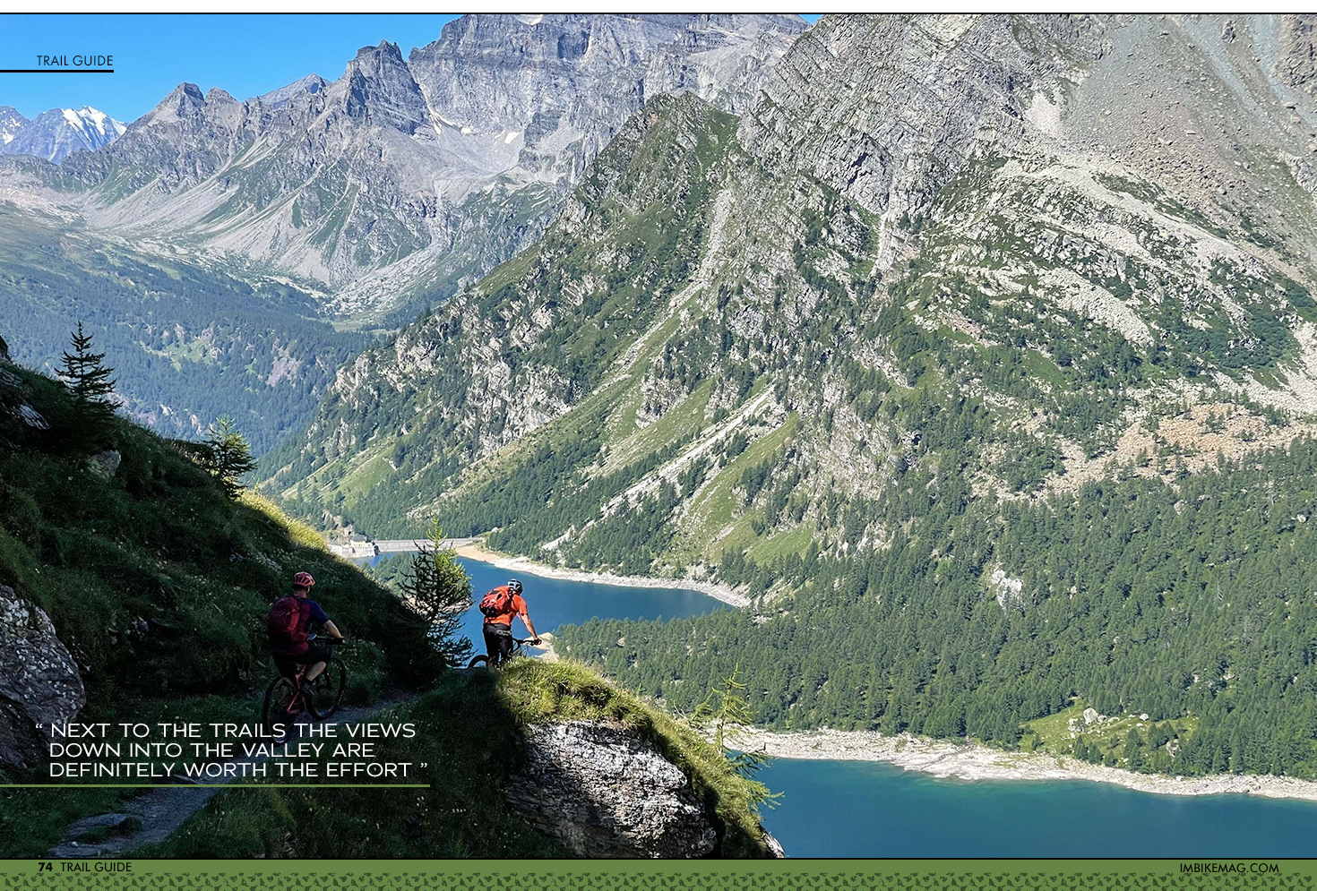
If you are not happy with climbing to the trail heads yourselves, an E-bike is a good idea for this region. So far, there is no shuttle service in the area yet. This may change with growing popularity. Until then, I’m happy to lose myself in pedalling. Next to the trails the views down into the valley are definitely worth the effort, and most of the climbs are on small and quiet but paved mountain roads.
Lost in summer
In summer I wouldn’t recommend riding these lower altitude trails – the forests are then filled with high fern and grass, and the trails sometimes vanish completely. Also, it can get pretty hot there.
Summertime is high alpine time – and bike park time! There are three bike parks in the region: One is located in Santa Maria Maggiore in Valle Vigezzo – it’s high on my own to-do list and not a real bike park but rather a chair lift that gives access to several presumably technical hiking trails leading back down to the valley. The second park is in the ski area of Domobianca (www.domobianca365.it) – I haven’t checked it, yet. The third one is located in San Domenico (www.sandobikepark.com) in Valle Cairasca above Varzo. I love its stunning high alpine views. It has a good main line and a couple of trail options in the upper area starting at 2’500 m a.s.l. For me this bike park serves an additional purpose: Its chair lift is the entry gate to some of my favourite remote high alpine backcountry adventures.
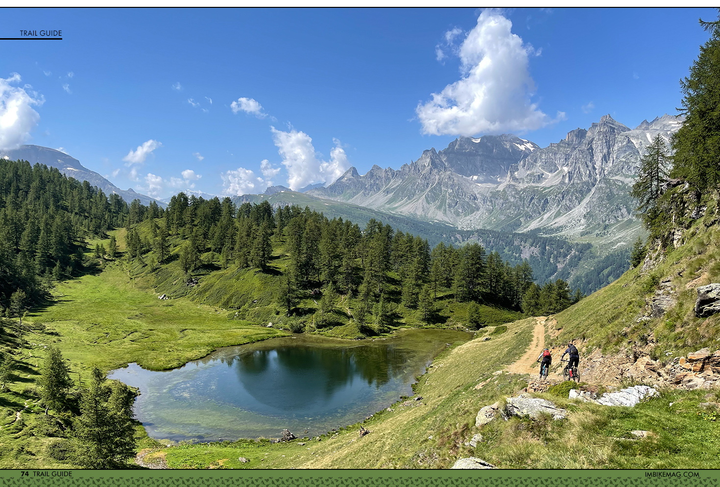
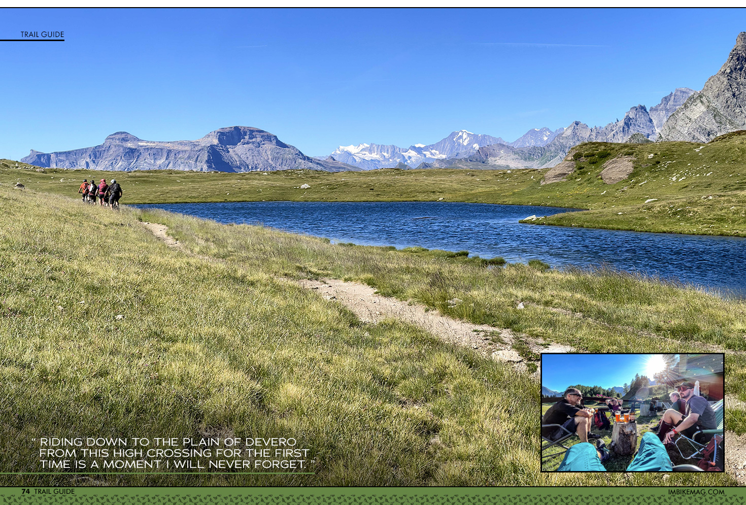
My summer highlight is the Alpe Devero. Its trail loop “Grande Est” seems to be the only route that is famous in Italy outside of the Ossola region. That’s for good reason: When I did it the first time on a recce trip I was overwhelmed by the scenery: A single trail that winds through a flat, grassy high alpine plain dotted with little lakes, crowned by views of the towering rock walls that form the border with the Binn valley on the Swiss side to the north. I could imagine such a landscape in central Asia but didn’t expect it here.
But there is more in Devero: After I finally did overcome my fear of steep exposed terrain, I found a way to enter this paradise via a pass that most likely has seen few bikers so far. Riding down to the plain of Devero from this high crossing for the first time is a moment I will never forget. It’s the missing link I had been looking for to integrate Devero into a multi-day alpine bike trip. Since I don’t mind carrying my bike uphill I love losing myself in this wild region.
Another favourite of mine in terms of multi day high alpine tours is linking the Simplon region to Domodossola. With four more days of reconnaissance (after getting lost in the woods) I found a route to my liking – wild and a bit tough. A crazy adventure typical for the region, way off any beaten track or heat map.
Lost in zuccherini and Crodino
Multi day means: Let’s bring some dolce vita to the game! There are plenty of wonderful mountain huts in the region. On Alpe Devero my favourite place to stay is in the beautiful alpine village of Crampiolo, either in the hut ‘La Baita’ or the ‘Agriturismo Alpe Crampiolo’. The first serves great typical alpine Italian food, the latter has quite a sophisticated kitchen for such a remote place with local beers and alpine spirits.
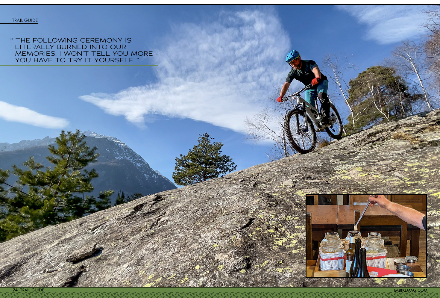
Once I stayed with friends at a mountain hut in the region, and we were – as usual – pretty stuffed by the enormous portions of delicious food. After dinner the hut keeper placed a couple of jars on our table. They contained sharp sugar cubes – ‘zuccherini’ in Italian – sitting in liquids of various colours. We got curious since something was odd about that sight, but we couldn’t tell what. The following ceremony is literally burned into our memories. I won’t tell you more - you have to try it yourself.
Flashback again to the tiny, almost invisible trail on the ridge from the beginning of this story:
Now that I'm back to civilization and are safe, super exhausted and glad to be standing upright, I decide to name that trail after those mysterious sugar cubes: “Zuccherino trail” (super sweet, but really easy to get lost).
I head straight to the Piazza dell Mercato in Domo for a proper Italian aperitivo, something that by now has become a ritual of sorts. My personal favourite bar is ‘La Bolleria’ (closed on Sundays) – their drink and wine list and choice of local cold cuts and cheese to accompany the drinks is well assorted. By now the staff knows me and my bike, so I’m usually greeted with a smile and “Una birra per la bici e un Spritz per lei?”
A good choice of Italian microbrewery beers and tasty vegetarian snacks can be found at Sali & Pistacchi just across the square. In summer they often have live music, too. If you are not into alcoholic drinks, go for a Crodino – a bitter lemonade produced in the village of Crodo north of Domodossola, which became quite famous.
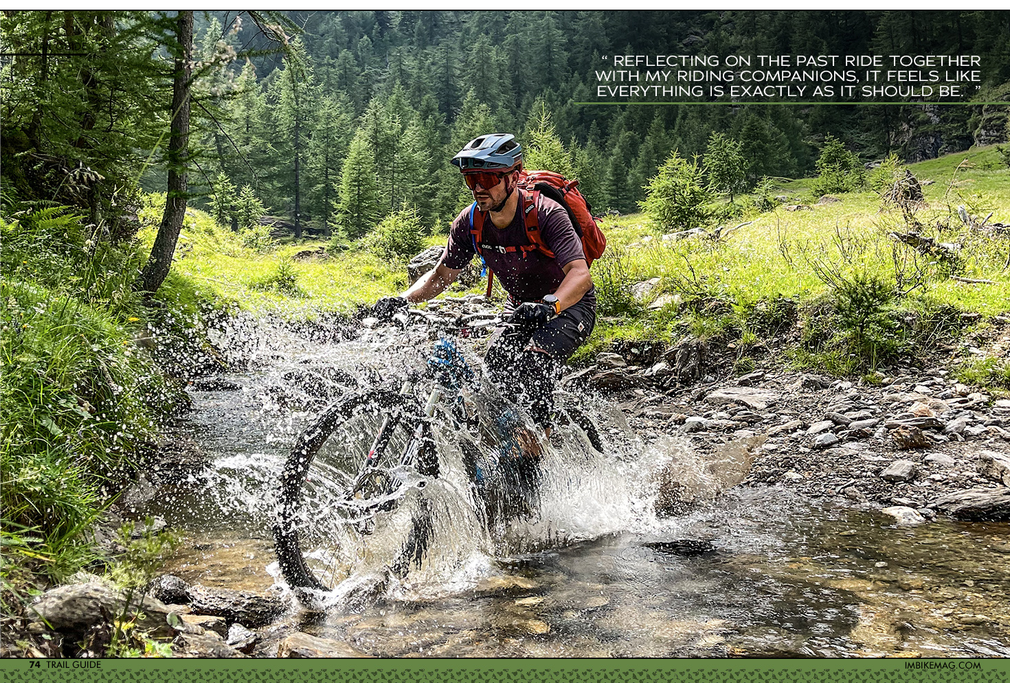
Whenever I’m sitting at this market square reflecting on the past ride together with my riding companions, it feels like everything is exactly as it should be. It’s always tough to take the train back home, but here in Switzerland we’re lucky: it’s not too far to get lost again in Ossola!
For planning your own trip to Domodossola check out the tourist office website: https://www.visitossola.it/en/ or scout the area on Google Maps here: https://goo.gl/maps/NtXker2oahS2wUGb7
If you want to join me on any of the adventures in this region, book a trip through my guiding company Trail Therapy: https://en.trailtherapy.ch/
By IMB
