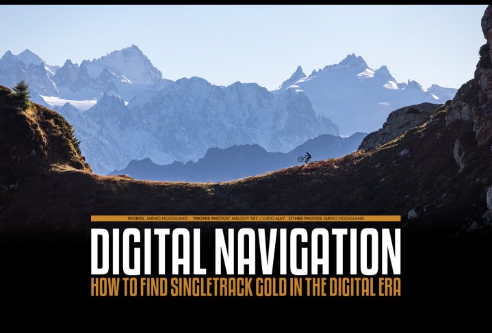
Digital Navigation
Issue 75 / Wed 26th Apr, 2023
How to find your way to the best trails using modern tools.
How to find singletrack gold in the digital era.
Finding an amazing trail in a new spot. It’s one of those things that makes riding mountain bikes special. The feeling of entering a new trail, narrow and snaking down the hill, mysterious and unknown. This is how a lot of the routes used to get explored. Just jump on the bike, pedal away and dive into every trail that has a whiff of being worthwhile. Paper maps were the hand book and the odd written guidebook were the tools for the job. Hit and miss were part of the game and when you did strike gold, a euphoric day went into the books.
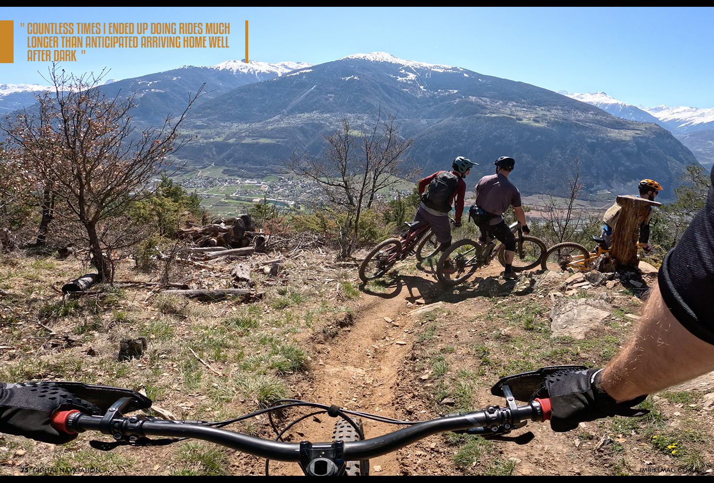
Finding good trails to ride has always been a more adventurous part of mountain biking, especially in pre cellphone times. You could actually get lost, hurt or end up miles from where you thought you were going and without a way to call for help. If you really got in trouble, you could always ring a stranger's doorbell (if you made it to civilization somehow) and call one of the few people who’s phone number you knew by heart. Countless times I ended up doing rides much longer than anticipated arriving home well after dark (sorry parents!).

Nowadays these scenarios are quite hard to imagine, in the digital era with 5G coverage, signposted routes and gpx files. But still it has taken quite some time for mountain bike trail knowledge to be available online, and even to this day there is a bit of effort involved in finding where to go and how to get there. With the GPS devices getting better and better and information more accessible by the month, we decided to do a dive into the state of things when it comes to finding trails and how to use the digital tools we have at the moment.
Internet as a source for singletrack
Besides the local tourist office and bike shops, a great place to scout for some good trails to ride is the good old interwebs. With a plethora of magazines, route finding apps and forums to browse through you can spend many rainy days planning your next adventure. Some websites are better than others, but the nicer ones provide pictures, a proper description on how technical the trail is and if you’re lucky even a POV video and the holy grail, a GPX file.
Trailforks and Strava are great tools to find some singletrack gold, but it does require some tinkering and luck. Some parts of the world are totally covered in properly named and documented trails, while others just have a few options available. Also, even though both websites/apps offer a free of charge version to use, the real functionality starts when you subscribe.
Pricing is reasonable, but the new trick of the modern world is subscriptions. Where first you were able to buy a paper map for 15 Euros / GBP / Dollars and enjoy them for a lifetime, we’re now condemned to paying a fiver a month for the rest of your life. Of course if you really want to, you can spend a rainy autumn month researching and downloading all the rides you plan to do for the next year and make use of the 1 month free trial to spend as little as possible.
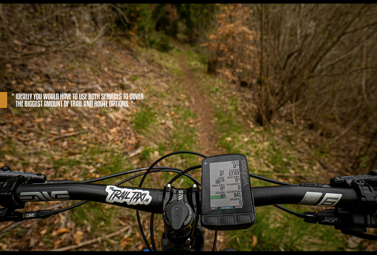
Trailforks pro sets you back 4.99 USD a month, while Strava hussle's 11.95 USD out of your pockets monthly. It is true that they provide a lot more than just a map service, with training logs, training plans, club rides, events etc. But we will dive into the pro’s and cons of these services in a future article. Depending how many new trails you want to explore, ideally you would have to use both services to cover the biggest amount of trail and route options.
There are a few ways to create a nice route from these platforms. One option is just to pick a route from the ones listed, as there are some really nice filters that you can apply. Another great option in Strava is to find a segment in an area where you want to ride or that looks promising on the map. By using the altitude lines you can get a gist of how steep the run is and how rideable the terrain might be for you.
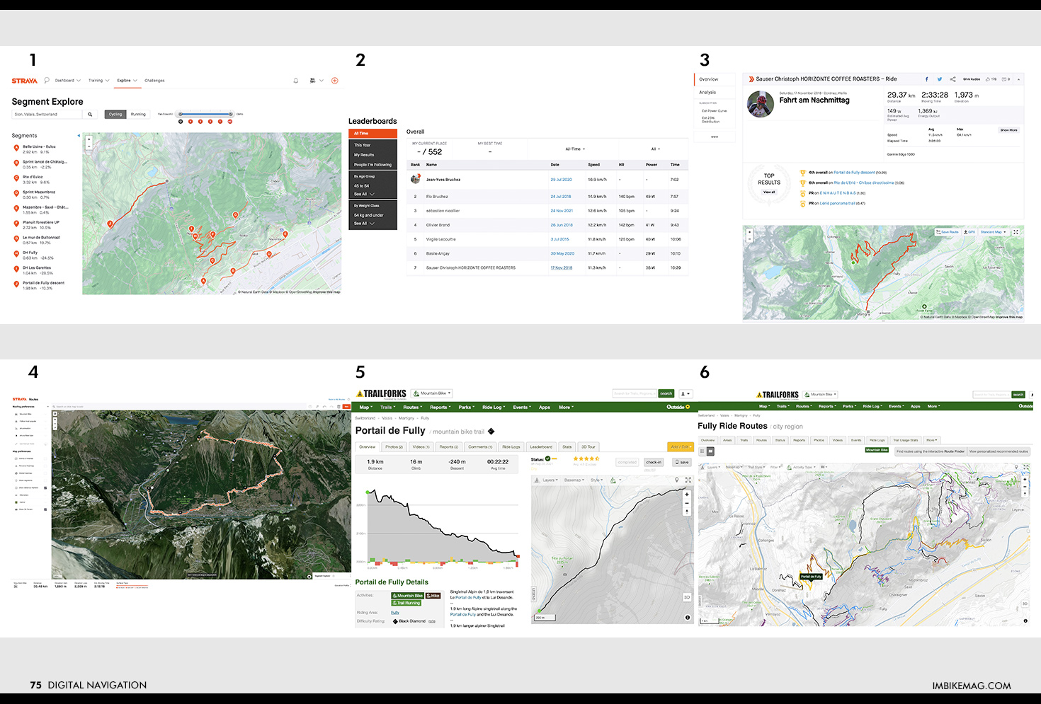
Using the Strava Segment Explorer function (1), I found a segment called “Portail Fully descent” that looked like a nice high alpine trail. From there you can check out the segment leaderboard (2) and pick a rider to see how he ended up on this segment and what the rest of his ride looked like. Now not all riders share all their data so you might need to check a few profiles. Bronze Olympian medallist Christoph Sauser in spot number 7 has his profile set to “public” and we can click and see his ride of that day (3).
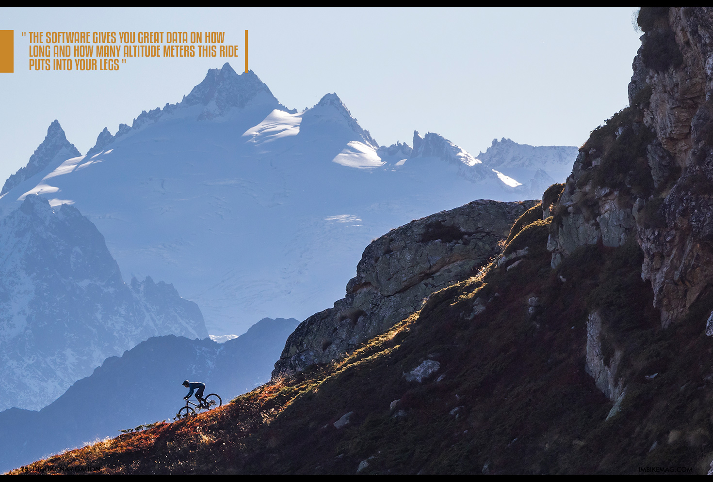
After checking out his ride overview, we can either download the GPX file directly, or save the route to our own profile. When you save the route to your profile, you can edit it to your liking to match your starting point or shorten it if you don’t have the same legs as Christoph. The software gives you great data on how long and how many altitude meters this ride puts into your legs (4).
Now in Trailforks (5), we have another method to find this same route. You can search for Routes within a certain area, like here you see the similar route listed as in Strava but with a different ending. The good thing about the Trailforks option is that there are more images and a better route description, but by combining the information from both platforms you can actually reach the best route result.
Taking it to the trail
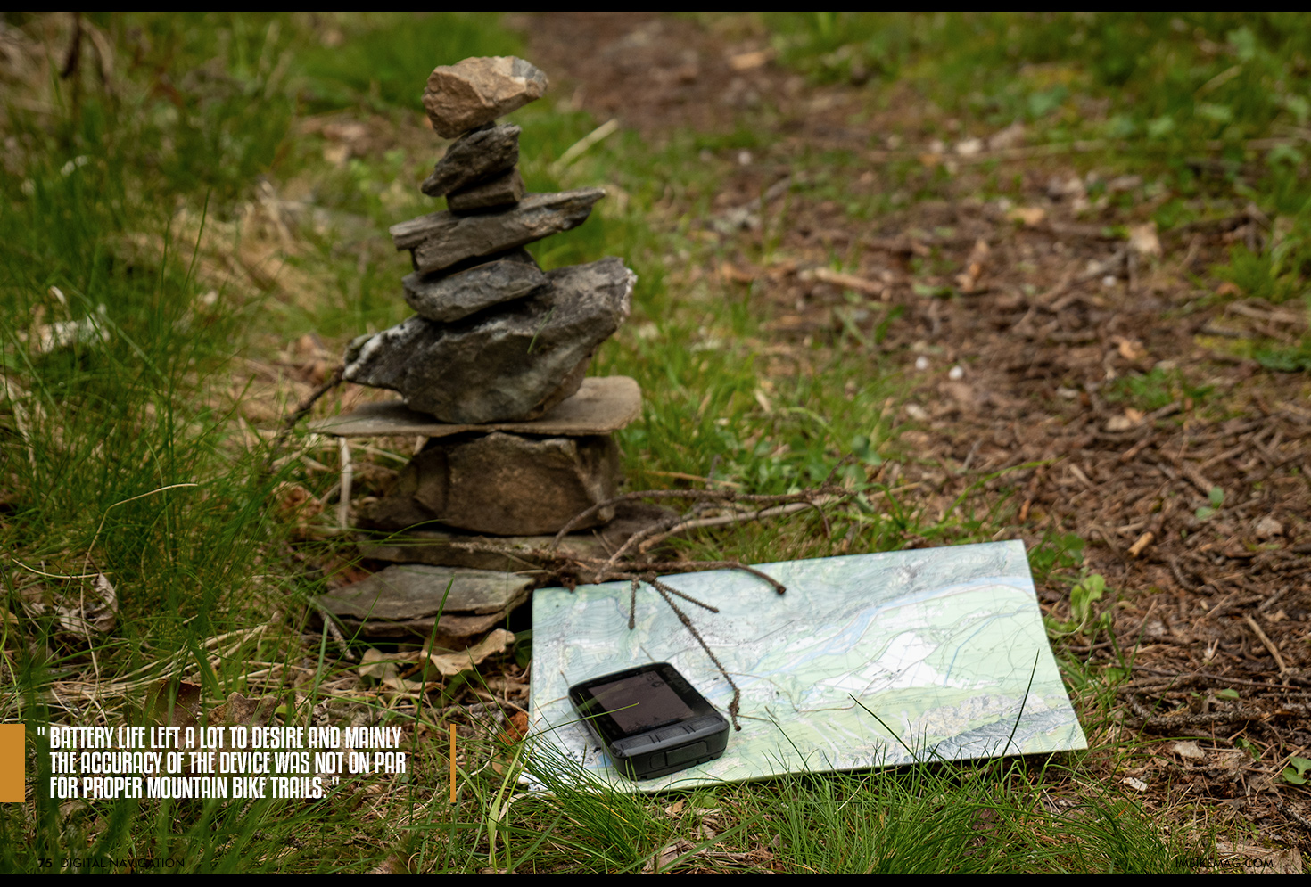
Now that we managed to get a GPX file, the next challenge is how we read this information while hurling ourselves down a rocky singletrack. When the first GPS devices came out in the mid 2010’s the devices were far from usable. Battery life left a lot to desire and mainly the accuracy of the device was not on par for proper mountain bike trails. It would lose connection, not have any details on the map itself and place you in a different spot altogether at times. Oh and they cost an arm and a leg to buy too.
Where do we stand now? Well these days we have a few options, let's start with the budget one, your phone. Combined with the right app, most modern smartphones can be transformed into your personal guide for the day. Gpx files can be imported easily, but there are definitely some drawbacks by going this route.
First of all, when using your smartphone the battery life can go quite fast as the device is doing a lot of other tasks in the background. If you run out of juice, you also cannot call anyone in case of an emergency. Also the device is fairly bulky and not to mention pricey and fragile. One over-the-bars excursion and you could be looking at a 800 Euro replacement bill. Technically you could go and get a second cheaper phone just for mountain bike navigation, but while you’re at it why not go for a dedicated device instead?
Next up is the smart watch. If you’re doing multiple sports and want to track health, recovery and other biometrics this could be a great option. Most of these devices have a great navigation option, but when it comes to mountain biking the requirements are a little different. Mounting it to your handlebars can be a bit tricky and checking where to go with the device on your wrist is not ideal.
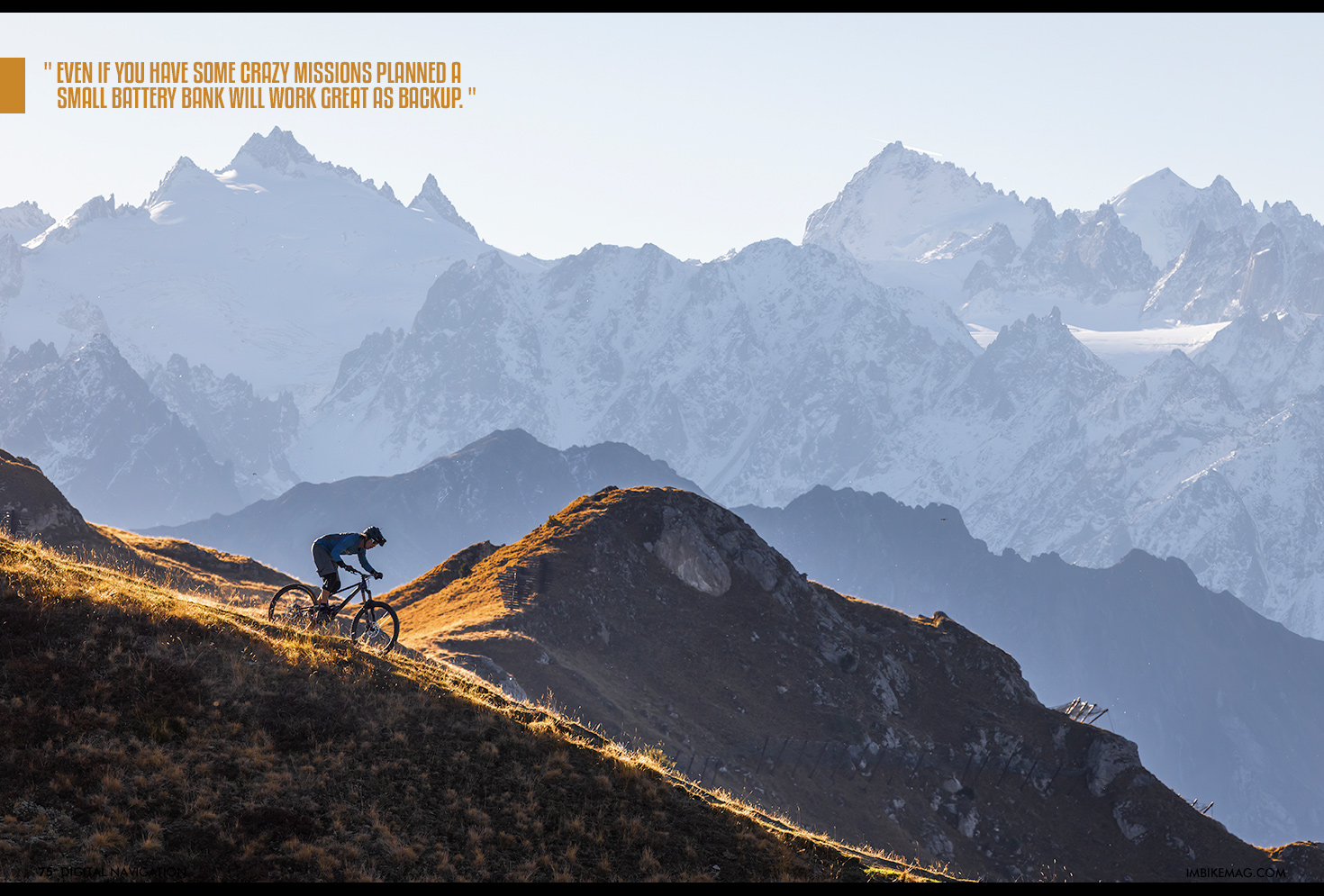
The best option is getting a dedicated device. Lately I have been using the Element Roam V2 device with Dual Band GPS, this technology makes a big difference in accuracy and with 32Gb of storage there is plenty of room for more maps than your legs can handle. It doesn’t come as a surprise to you that battery life is no longer an issue. Most devices last 15+ hours or more and allow USB charging while being in use, so even if you have some crazy missions planned a small battery bank will work great as backup.
Besides recording your rides and linking them to Trailforks or Strava, you can also do the reverse and load any route onto the bike computer through the app on your phone. Need to abort the adventure? No problem, just click on return to the starting point and the device will find the best way back for you.
Do you still need a paper map or a MTB guide?
Can we bin all the paper maps and do all guides need to rebrand themselves as influencers? Definitely not. Paper maps are still a great backup for any big adventure. Although the technology has become functional, having a backup paper map is still no luxury especially on multi day trips in far away places. Besides, some people find more pleasure in staring at a paper map on the kitchen table searching for good looking wiggly lines that could potentially be the trail of the year.
And the guides? Well, they do a lot more than just showing the way. They take away the work of planning the adventure, which for some is a burden. Also, a good guide will alter and fine tune the day according to the riders skill and fitness. With a ton of options in his mind, the guide will make sure you get back before dark and in one piece. Safety is a big aspect of guiding and the requirements of risk assessment, first aid and emergency repair skills will be hard to replace by technology.
Where does it go from here?
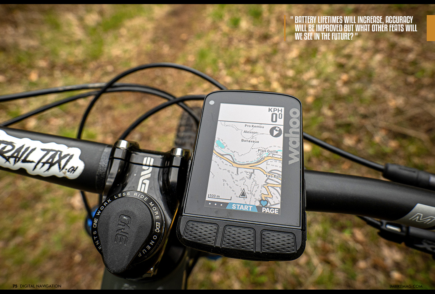
So it's safe to say that using digital tools to create a proper singletrack adventure is doable with modern technology. There still is some mystery to it all, but with some time spent you can plan and execute your adventure. Of course battery lifetimes will increase, accuracy will be improved but what other feats will we see in the future?
After a quick chat with some people in the industry it is clear they have plenty of projects in the pipeline. Safety is one of the pillars where they see opportunities for improvement. Already you can share your exact location with your friends or partner, but things like crash detection and weather warnings are on the horizon.
Another item is biometrics. Not only for those taking training seriously, but also for people that just want to pedal and forget. Already you can link your blood glucose monitor to your GPS device, albeit at a hefty cost. But you can think of hydration and nutrition reminders and personal riding level route suggestions based on your physical abilities. The main aim however is improving the user experience. Making it intuitive to find and upload routes with as little distraction from riding bikes as possible.
This sounds like a great ideal to me, and we will make sure to keep you updated on this tech in the future!
By IMB
